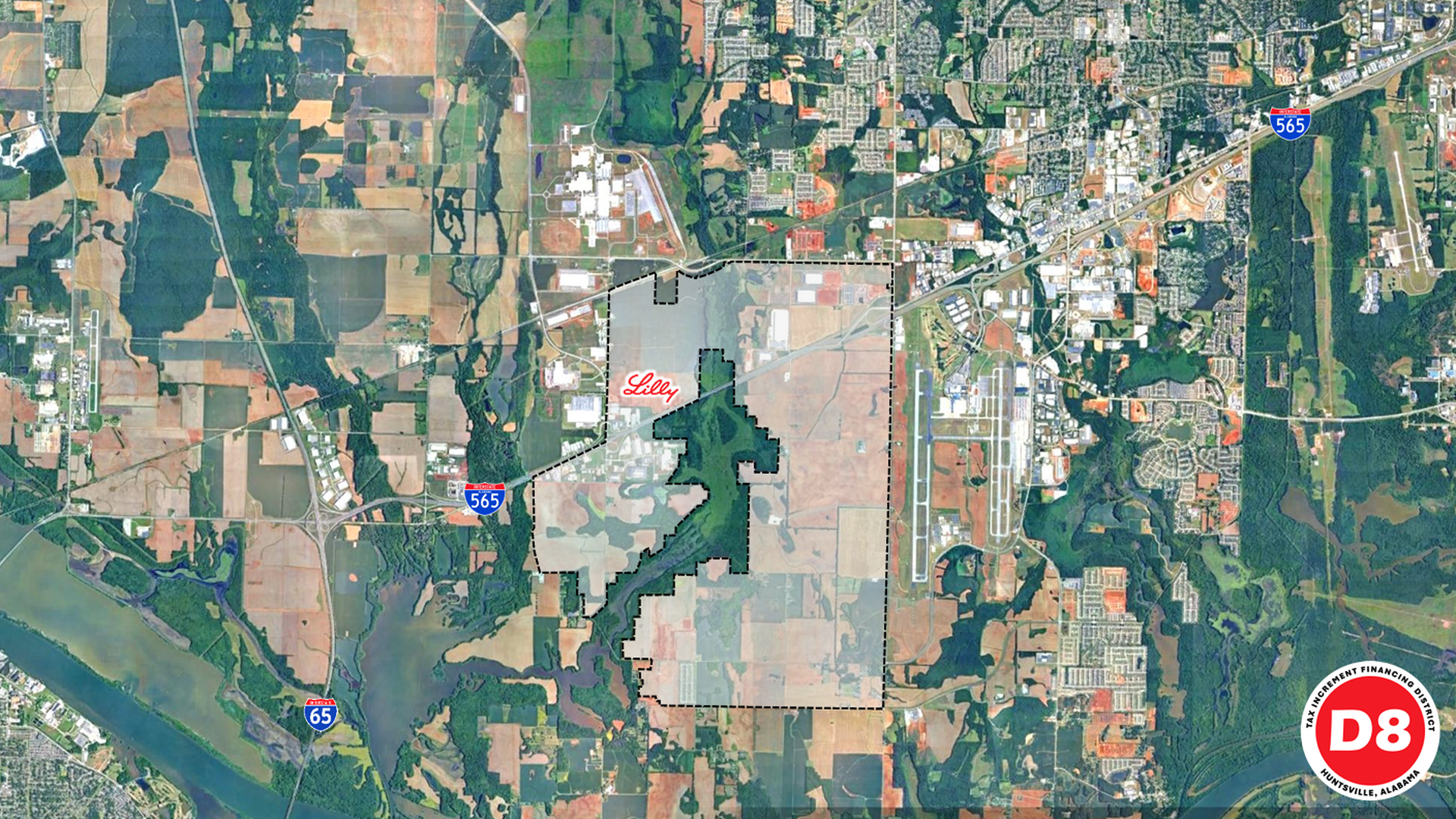
This is a rough boundary of the 9,000-plus-acre district, just to the west of Huntsville International Airport. Image: Courtesy City of Huntsville
Huntsville's latest TIF, or Tax Increment Financing District, is a big one in more than size.
Why it matters: The new district will provide Huntsville with a method to fund infrastructure improvements to support Eli Lilly's $6 billion plant, and potentially spur more development in Huntsville's next growth corridor.
Zoom in: Shane Davis, Huntsville's director of urban and economic development, told council members Thursday that this district, TIF 8, has been in the works for years.
The roughly 9,000-acre district encompasses that size, and a large area to the west of Huntsville International Airport, to the north and south of I-565.
They cap property tax revenue from the defined district at current levels and capture new tax revenue from development-driven increases in property values to fund debt service on infrastructure improvements.
Context: Exact plans for infrastructure or other projects to be funded by the TIF weren't presented Thursday, but "generally speaking, we know the road projects and utilities that need to occur in this general area moving forward," Davis said.
The city council authorized staff to prepare that project plan, then present it to the council for approval. The city says road projects are a particular focus.
The bottom line: "(Eli Lilly) is a known investment coming, but to win those projects, we have to make commitments in public construction," said District 5 Council member John Meredith.