More optimism in this forecast

Add Axios as your preferred source to
see more of our stories on Google.
The forecast for winter weather this weekend is changing, and while much of the Southeast braces for impact, Huntsville's outlook appears to be improving.
Why it matters: Temperatures are trending warmer, meaning expected precipitation is set to be less impactful than earlier forecasts.
- But Huntsville's not quite in the clear.
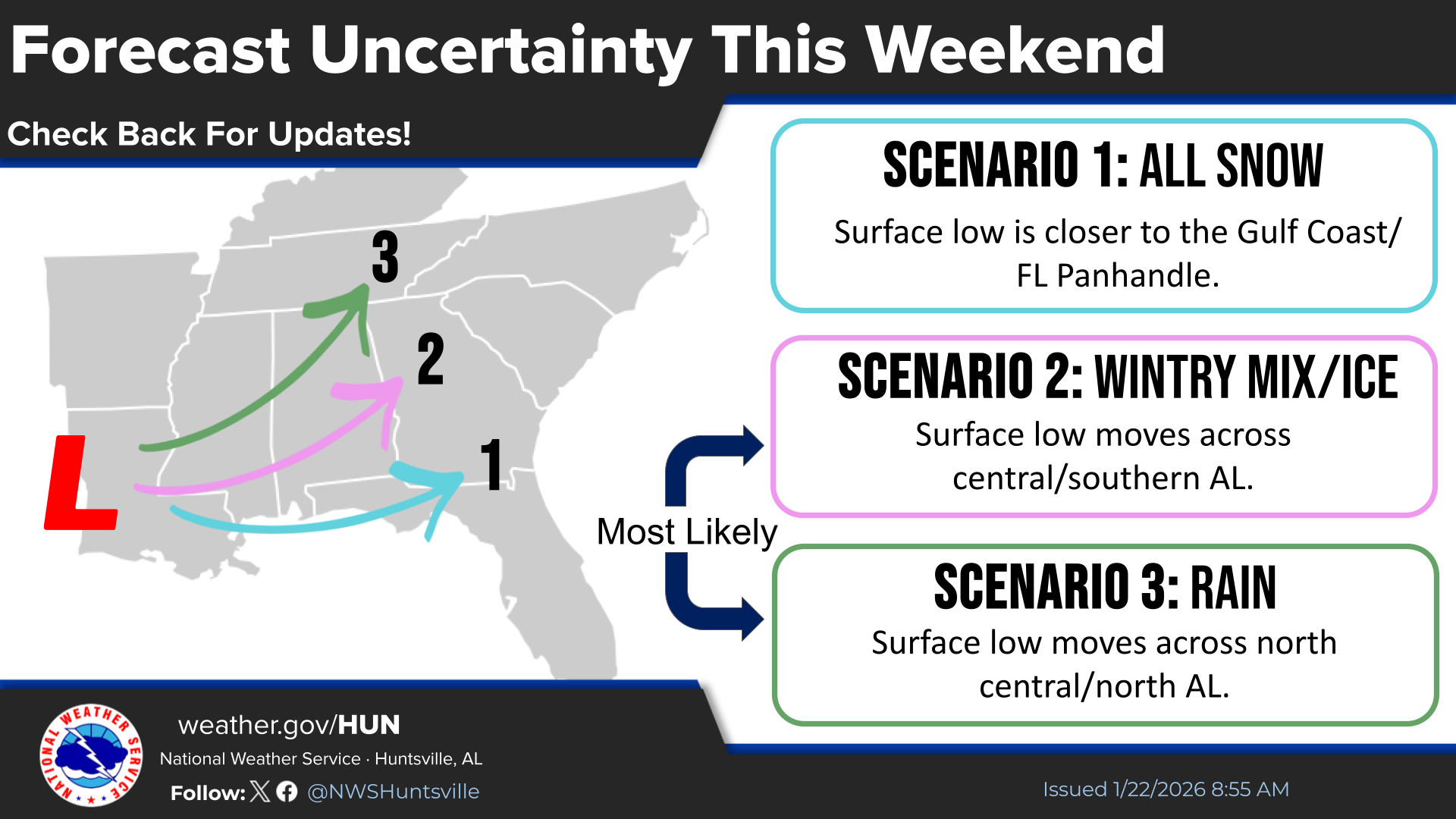
How it works: A low pressure system moving east is bringing the weather, and in recent days has been trending on a more northward route, bringing more warm air with it, said Katie Magee, meteorologist with the National Weather Service in Huntsville.
Zoom in: The focus for Huntsville will be the bookends of the storm: When it arrives late Friday or early Saturday and when it moves out late Sunday or early Monday, per Magee.
- Essentially, it's watching out for where sub-freezing temperatures overlap with precipitation, resulting in freezing rain and ice, and all the problems that can cause, like slick roads and power outages.
The latest: NWS issued a Winter Weather Advisory Thursday, starting Friday night and continuing through Sunday at 6pm, with expected mixed precipitation.
- The storm will likely arrive tomorrow between 9am and noon, Magee said, bringing mostly rain, but it could start as freezing rain depending on the temperature.
- "Then it's a race to see which arrives first, the sub-freezing temperatures or the dry air," she said, of the tail end of the storm late Sunday or early Monday.
By the numbers: The current forecasted low for Monday morning is 14, with the windchill feeling more like 2, she said.
- It won't warm up much during the day Monday, with temperatures struggling to reach the upper 20s, and that means any moisture left on roads will become black ice.
The bottom line: Stay prepared. Just a little ice can have a big impact.
More from Axios: Inside NWS' effort to forecast this week's potentially historic winter storm