High humidity has Charlotte feeling tropical

Add Axios as your preferred source to
see more of our stories on Google.
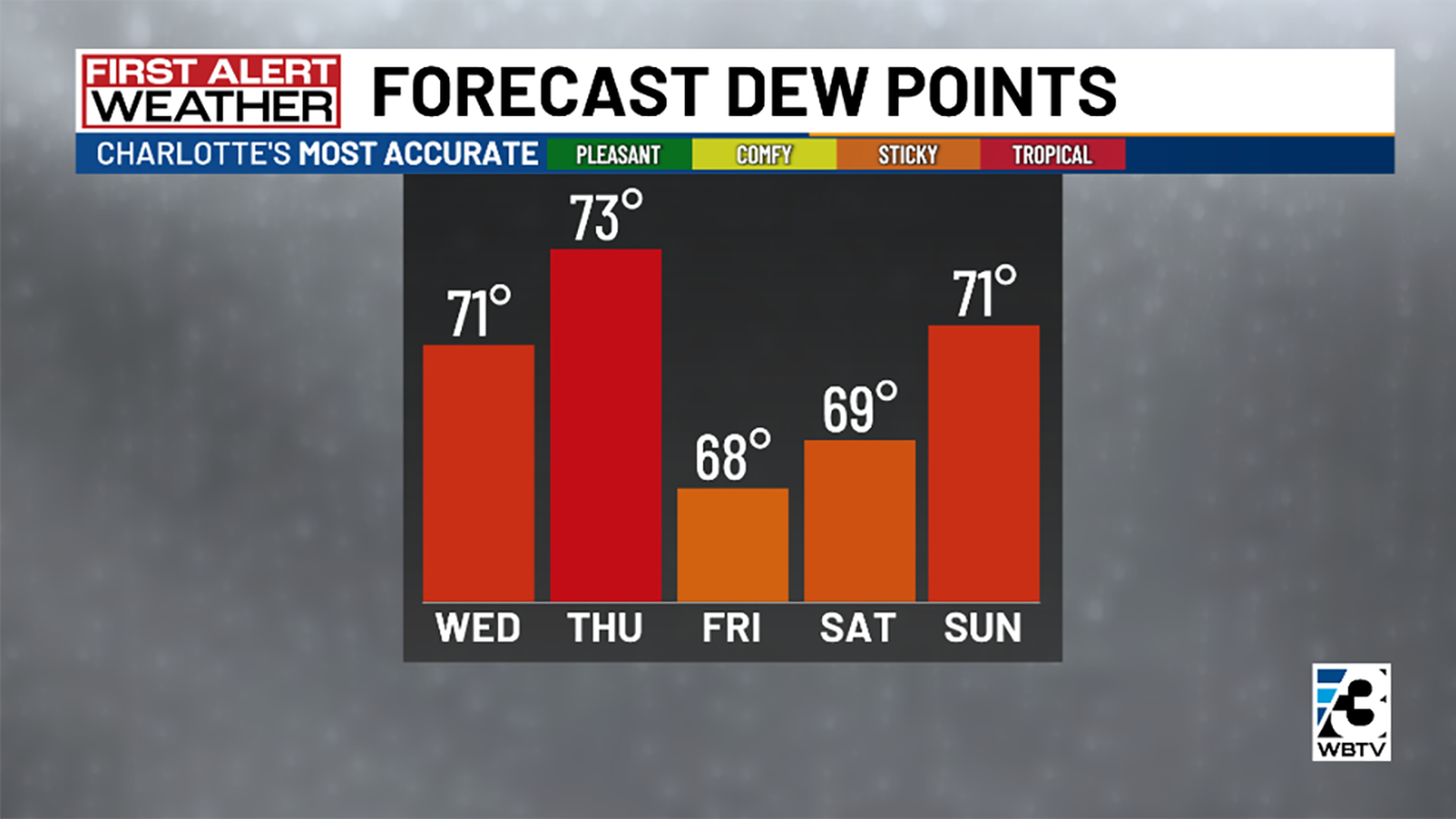
Chart: Courtesy of WBTV
It's not your imagination. Charlotte is extra humid right now.
Why it matters: Added moisture makes hot temperatures feel even hotter, according to meteorologist Rachel Coulter with our news partners WBTV.
Context: Conditions feel so damp because of dew points in the low to mid-70s.
- "Dew points are 'the temperature to which air must be cooled in order to reach saturation' as defined by the National Weather Service, Coulter says. "Or in other words, a measure of atmospheric moisture."
- Dew points are considered pleasant in the 40s, comfortable in the 50s, sticky in the 60s and tropical in the 70s.
The intrigue: Dew points in the low to mid 70s in June are above-normal when you look at 1991-2020, Coulter says. Instead, they're more common during July and August in the Carolinas, particularly on the coast.
Zoom in: High pressure off the East Coast is behind this weather.
- "With winds rotating clockwise around high pressure, that means winds are ushering in tropical moisture off of the Atlantic Ocean into the Carolinas," Coulter says.
- This has led to temperatures feeling hotter, plus more rain and thunderstorms.
What's next: The dew point is expected to hit 73 Thursday before dropping into the high 60s on Friday and Saturday and jumping back into the low 70s Sunday.
- "The relief won't be super noticeable and will be brief, but we'll take what we can get," Coulter says. "This is thanks to a cold front that will spark our next best chance for strong to severe storms on Thursday."
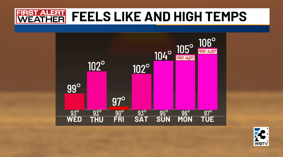
What we're watching: WBTV has First Alerts for Monday, June 23, and Tuesday, June 24, as temperatures are forecast to feel like 105 degrees and higher.
- "Anticipate these uncomfortably high dew point temperatures to continue into the official start of summer, (with) just one dip expected in the short term," Coulter says.