Cross Charlotte Trail: Long-awaited greenway project will make Charlotte more pedestrian-friendly

Add Axios as your preferred source to
see more of our stories on Google.
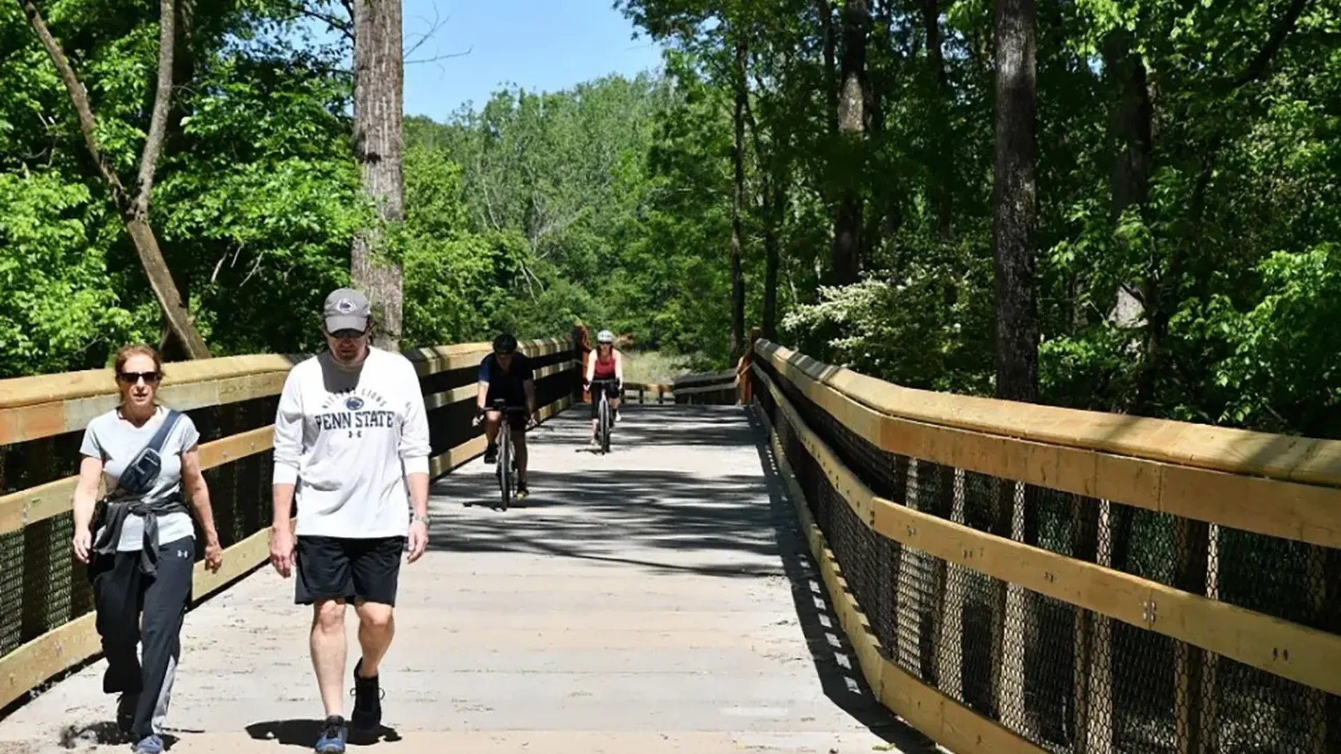
South Charlotte Connector, which opened last spring. Photo: City of Charlotte
Imagine being able to bike — or walk or run or scooter — from Ballantyne all the way up to PNC Music Pavilion.
That’ll one day be possible on the Cross Charlotte Trail, a nearly 40-mile trail and greenway network that will stretch from the South Carolina state line, up through Charlotte and all the way out to the UNC Charlotte campus and the Cabarrus County line.
Why it matters: The trail, which is divided into a dozen segments, will close gaps between existing greenways and build new ones to create a huge network of trails, offering a safe, alternative mode of transit. All told, the total price tag of the trail network will be more than $112 million.
- Project planners say that roughly 140,000 residents and 130,000 jobs will be within walking distance of the trail when it is complete.
- The project is years in the making; work began in 2015 and will wrap up sometime in 2026.
The big picture: The network advances the city’s sustainability goals by reducing the reliance on cars, city leaders say. People should be able to use the trails to accomplish daily needs like commuting by bike into Uptown, says Scott Curry, an urban designed and active transportation coordinator for the City of Charlotte.
“Part of the thinking was recognizing that our greenways, which have traditionally been recreation infrastructure, could provide a really amazing opportunity to serve as daily transportation infrastructure if we connect them in meaningful ways,” Curry says.
What’s happening: The city’s proposed 2022 budget includes $20.5 million to complete its last two segments (10 and 11) over the next five years. Different segments of the trail network are in various stages of completion.
Here’s a rundown of where each of the segments stands:
- ✅ South Charlotte Connector — Park Road to McMullen Creek: Complete
- 🚧 Brandywine to Tyvola: Under construction
- 🚧 7th to 10th streets: Under construction
- ✅ Parkwood Avenue to Davidson Street at 24th: Complete
- ✏️ Davidson Street to Matheson Avenue: In design. Construction will begin soon and will wrap up next year.
- ✏️ Matheson Avenue to Craighead Road: In design
- ✏️ Craighead Road to Tryon Street: In design
- ✏️ Tryon Street to Orr Road: In design
- ✏️ Orr Road to Rocky River Road: In design
- ✏️ Mallard Creek Church Road to Pavillion Boulevard: In design
- ✏️ Pavillion Boulevard to Cabarrus County: In design
Additionally, the county is working on a handful of other segments, including:
- Tyvola Road to Huntingtowne Farms (complete)
/2024/01/06/1704502648626.jpg)
- Huntingtowne Farms to I-485 (complete)
- I-485 to Polk State Historic Site
- Polk State Historic Site to S.C. State Line
- South Charlotte Connector, which will connect Park Road to the Polk Historic Site.
Flashback: In 2019, city manager Marcus Jones disclosed that the Cross Charlotte Trail was $77 million over budget, putting the entire project in jeopardy, as the Observer reported at the time. Jones blamed the shortfall on poor budgeting and the rising cost of land and construction, per the Observer.
- “The segments we are building are through developed urban dense areas with lots of constraints, or along creek segments that are incredibly challenging to build in,” Curry says.
- The city allocated additional funds to fund and design the trail in the next fiscal year’s budget.
What’s next: The Charlotte MOVES task force, led by former mayor Harvey Gantt, recommended in its recent report adding an east-west trail network. The Cross Charlotte Trail (XCLT) 2.0, as it’s being called, would run from the Catawba River (US National Whitewater Center), through Charlotte and down to Matthews.
- The XCLT 2.0 would run east-west just like the proposed Silver Line will. It’s similar to how the Cross Charlotte Trail runs south to north as the Blue Line light rail does.
- “It’s not a mistake that a lot of our greenway segments connect to existing and planned transit corridors,” Curry says.