How to spend a weekend hiking the Foothills Trail in South Carolina, 3 hours from Charlotte

Add Axios as your preferred source to
see more of our stories on Google.
We all know and love North Carolina’s mountains. But South Carolina’s high country is worth checking out, too.
OK, maybe “high country” is a stretch. But there are still plenty of waterfalls, gorges and steep trails to explore.
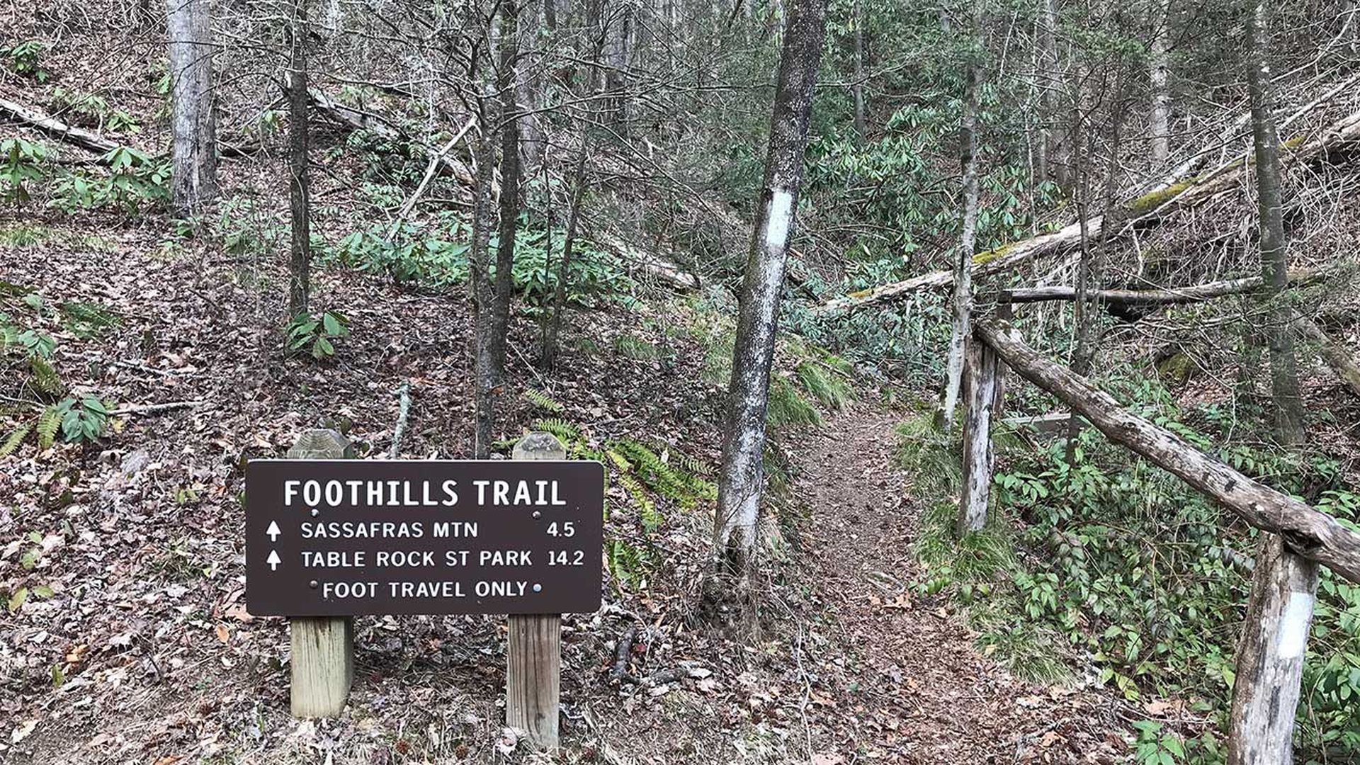
One of the best places to do this is on the Foothills Trail, a 77-mile path that winds its way through both Carolinas near Greenville, S.C.
A bonus: You can also use South Carolina’s premier trail to extend your outdoors season almost year-round. While it was snowing in the North Carolina mountains the weekend I went, it never got below freezing on the Foothills Trail.
Here’s a decent way to do it.
/2024/01/05/1704485523735.jpg)
Getting there
You’re basically driving to Spartanburg, then spending another hour on some South Carolina rural highways.
/2024/01/05/1704485524215.jpg)
I’d recommend starting at Sassafras Mountain, the highest point in South Carolina. Might as well, right? It tops out at 3,563 feet — roughly half as tall as Mount Mitchell.
Still, it offers some pretty nice views. There’s even cell service here for your last Instagram before heading off into the woods.
/2024/01/05/1704485524675.jpg)
Hiking
From Sassafras Mountain, you have a good number of options. There are several state parks within a day’s hike.
I headed west on the trail toward Laurel Valley. From there, the itinerary is endlessly customizable, with several access points along the way. However, you’re likely looking at an out-and-back instead of a loop hike.
/2024/01/05/1704485524973.jpg)
/2024/01/05/1704485525263.jpg)
But this way has the benefit of two falls you can check out. The first you’ll encounter is about 8 miles from Sassafras Mountain, called the Virginia Hawkins Falls.
/2024/01/05/1704485525769.jpg)
Three miles later, you’ll hit a much bigger waterfall — the Laurel Fork Falls.
/2024/01/05/1704485526095.jpg)
/2024/01/05/1704485526466.jpg)
If you’re counting at home, that’s 11 miles one way. If you’re a monster, you could double back and finish this as a 22-mile day hike. If you’re a normal person, you’ll camp at some point and make it a weekend trip.
Camping
For some reason, the Foothills Trail people don’t tell you where the good camping spots are online. You can buy a map ahead of time, or wait until you get there and scout one out.
Luckily, there are plenty of established campsites along this stretch of trail, with water access and fire rings.
One particularly good one you can ready by way of the Eastatoe Gorge Spur Trail. That will add 6 miles round-trip to your route.
Otherwise, there are several campsites around the Virginia Hawkins Falls.
/2024/01/05/1704485526901.jpg)