Satellites fight illegal gold mining in the Amazon

Add Axios as your preferred source to
see more of our stories on Google.
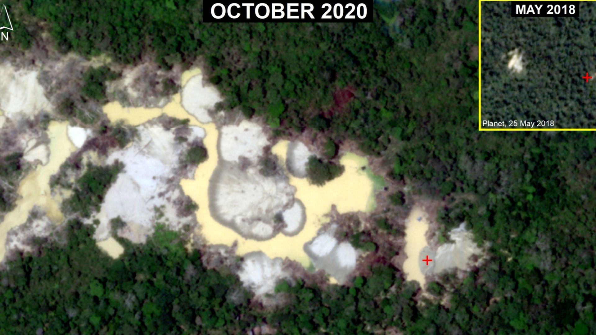
Deforestation as seen from space. Photo: Planet Labs Inc.; Analysis: MAAP
Near real-time satellite images of the Amazon are revealing deforestation and helping to combat illegal gold mining operations in the rainforest.
The big picture: As satellite data and analysis advances, researchers and companies on Earth have found new ways to make use of it — from helping to regulate the fishing industry to monitoring farming.
What's happening: Over the course of the last year, deforestation related to gold mining in six sites in the Peruvian Amazon decreased by about 78%, and 90% in La Pampa, Peru, which is considered a critical area.
- That reduction has been aided by the Amazon Conservation's Monitoring of the Andean Amazon Project (MAAP), which uses data from Planet's fleet of satellites and others to spot deforestation from space.
- "Just having that near-daily imagery availabilities has been a huge game-changer in terms of quickly getting eyes on these alerts," MAAP's director Matt Finer told Axios. "Since Planet has been doing this now since 2016, I believe they now have a robust archive, where we can then go back in time and kind of piece together, exactly what happened."
How it works: The MAAP team starts off with Landsat data in pixel form, showing possible areas of concern, where deforestation may be happening.
- From there, the team can zoom in on an area using Planet data that will show changes from day to day and month to month, allowing Finer and his team to pick out where deforestation is expanding.
- The MAAP team can then request that a higher resolution Planet satellite take a photo of the area of interest, which can be shared with local governments.
- "You have the government action, and then it loops back ... into the technology where we then monitor the effectiveness of the action," Finer said.
Yes, but: Satellite data and its usefulness is still limited by what governments and other actors are willing to do on the ground.
- MAAP is able to monitor the entire Amazon, and Finer and his team are hoping to find more willing government partners to help stop deforestation elsewhere.
