"Dangerous" winds boost already-reeling LA area's wildfire risk

Add Axios as your preferred source to
see more of our stories on Google.
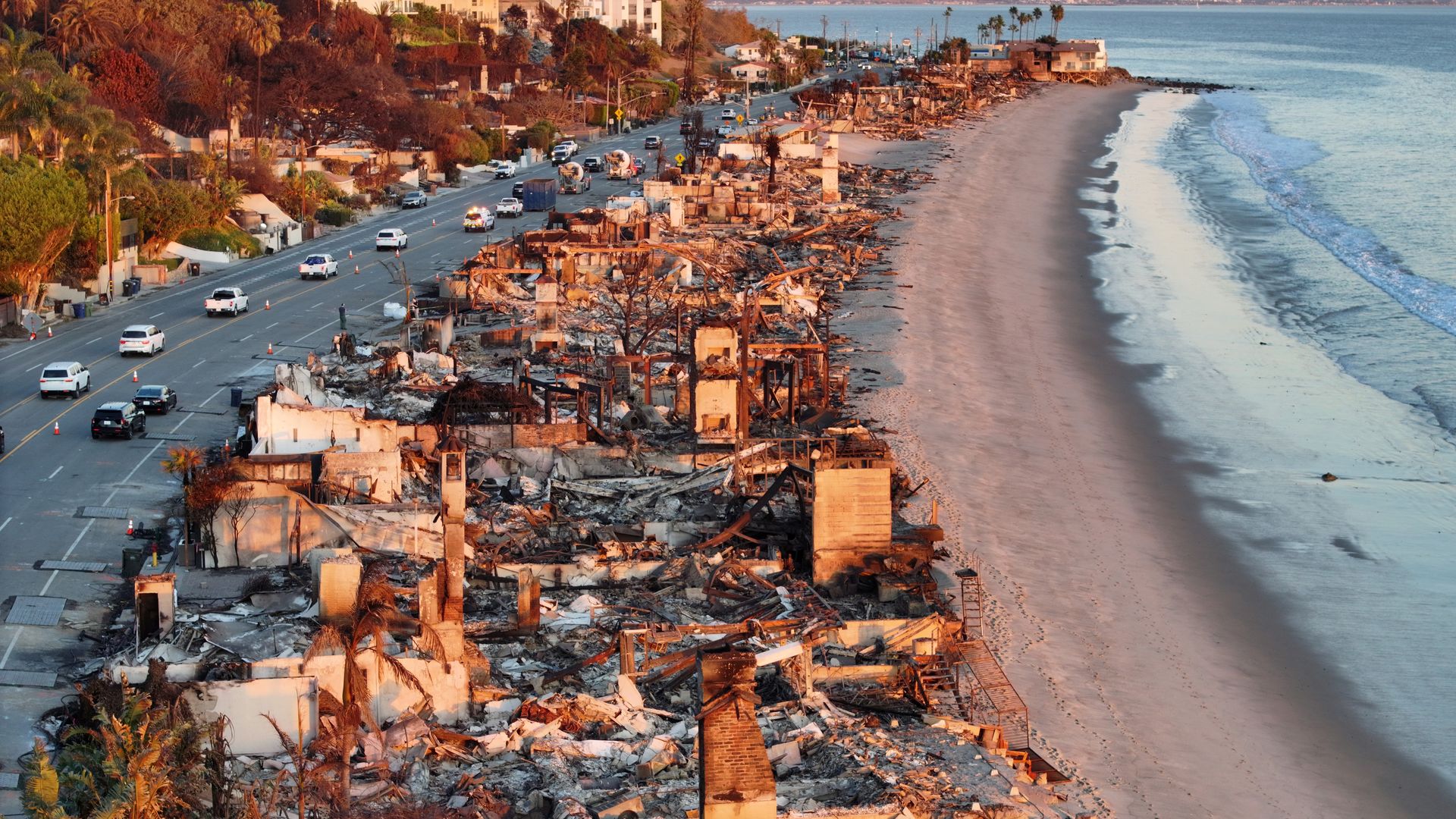
An aerial view of repair vehicles at sunset passing near beachfront homes that burned in the Palisades Fire on Jan. 15 in Malibu, California. Photo: Mario Tama/Getty Images
The National Weather Service issued its highest fire weather alert level for portions of the Los Angeles area for Monday into Tuesday morning, as powerful Santa Ana winds return.
Threat level: The "Particularly Dangerous Situation" Red Flag Warning indicates any fires that ignite could quickly grow out of control.
- The warning, for winds gusting up to 100 mph in higher elevations and 60 to 80 mph in some lower elevations, also means the devastating fires that are still burning may be tougher to further contain during this period.
- The Storm Prediction Center, which forecasts fire weather conditions nationally, has designated parts of Southern California as being in "extremely critical" fire weather risk on Monday and Tuesday.
- This zone includes Glendale, Oxnard, Santa Clarita and Palmdale, Calif., with LA in the still serious "critical risk" category.
In all, 14 million people are included in the "critical" to "extremely critical" risk areas.
Zoom in: "The latest in a seemingly endless series of Santa Ana wind events
was beginning to unfold across the region early this morning," forecasters at the NWS' LA office wrote in a forecast discussion Monday morning.
- This event is partly related to the Arctic blast affecting most of the Lower 48 states, with cold air surging into the Great Basin helping to fuel dry, offshore winds across Southern California.
- Much of Southern California is enduring its driest start to the wet season on record, with LA picking up just 0.16 inches of rain since May 6.
- Typically, January is a wet month in the region.
Context: The extraordinarily dry start to the winter wet season this year has caused the fire season, which typically ends by late fall, to stretch much deeper into the winter than usual.
- This means it overlaps with more high wind events — something that climate studies show becoming more common in coming decades.
The big picture: The region is suffering from hydroclimate whiplash worsened by human-caused climate change.
- The Eaton and Palisades Fires have been some of the most destructive blazes in California history, and are estimated to have caused at least $20 to $30 billion in damages, possibly higher, per various insurance company estimates.
- They have killed at least 27 people.
- The two largest fires are still burning, but firefighters have made gains in controlling them.
- President-elect Donald Trump plans to visit the LA area on Friday to tour the damage.
What's next: Similarly dangerous conditions are expected for Tuesday, when parts of San Diego County will be included in the "extremely critical" fire weather area.
- In addition, A fire weather watch is in effect for Tuesday evening through Thursday evening across much of LA and Ventura counties, due to the threat of additional Santa Ana winds this week.
- No rain is in sight for Southern California for at least the next five days, with some hints of a wetter weather pattern thereafter.
Go deeper:
