Tropical Storm Ernesto intensifies as it nears Puerto Rico

Add Axios as your preferred source to
see more of our stories on Google.
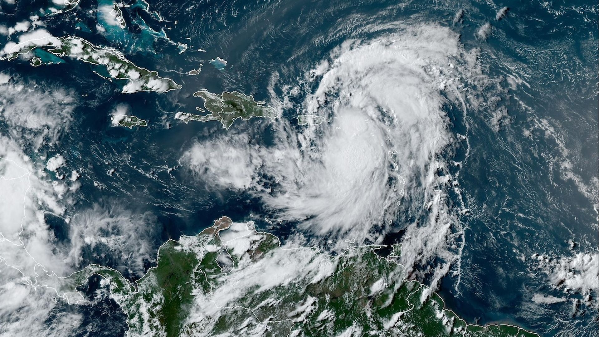
Satellite image of an intensifying Tropical Storm Ernesto on August 13 as it moves toward Puerto Rico. Image: NOAA
Tropical Storm Ernesto is intensifying as it moves across the northern Leeward Islands, toward the Virgin Islands and Puerto Rico.
Why it matters: Puerto Rico's electrical grid is still highly vulnerable to high winds and heavy rains, despite extensive rebuilding projects since 2017's devastating Hurricane Maria.
Zoom in: Ernesto is forecast to become a hurricane on Tuesday night, as it passes over the Virgin Islands and just to the north-northeast of Puerto Rico.
- The storm may become a major hurricane of Category 3 intensity or above as it moves into the open Atlantic, and when it nears Bermuda on Friday into Saturday.
- However, as of Tuesday afternoon at 5pm ET, its maximum sustained winds were at 60 mph, up from 40mph earlier in the day.
- Heavy rainfall is still its biggest threat to Puerto Rico, but a long duration of tropical storm force winds will also be felt there, with hurricane-force winds possible in Vieques.
- A dip in the jet stream, also known as a trough, will act as a blocking mechanism for the East Coast, keeping Ernesto from directly threatening the Lower 48 states.
Between the lines: Puerto Rico has set ambitious electricity goals, such as meeting 100% of its electricity needs with renewable energy by 2050.
- However, progress in shoring up the reliability of the grid — much of which is connected to transmission lines in mountainous regions — has been slow.
- Hurricane Fiona in 2022, a Category 1 storm, demonstrated the ability of even relatively modest hurricanes to cause lengthy blackouts on the island.
- The Department of Energy, along with the Department of Housing and Urban Development and other parts of the federal and local governments, have devoted more than $1 billion to rebuilding the island's electrical infrastructure and make it more resilient.
- Solar power, microgrids and other technologies are being deployed there as well.
What's next: Ernesto's closest pass to Puerto Rico will come Tuesday night through Wednesday, with most models putting its center just to the east of the island while it is intensifying.
- Even without a direct hit, strong winds and heavy, flooding rains of up to 10 inches are likely, with possible mudslides.
- The National Hurricane Center is predicting the heaviest rains to fall in eastern Puerto Rico, Vieques and other nearby islands.
What we're watching: How quickly the storm consolidates its thunderstorms and is able to intensify, which will help determine its impacts in Puerto Rico.
Go deeper: NOAA forecasts extraordinarily busy Atlantic hurricane season
