Storm Ciarán to strike U.K., France with flooding rains, high winds

Add Axios as your preferred source to
see more of our stories on Google.
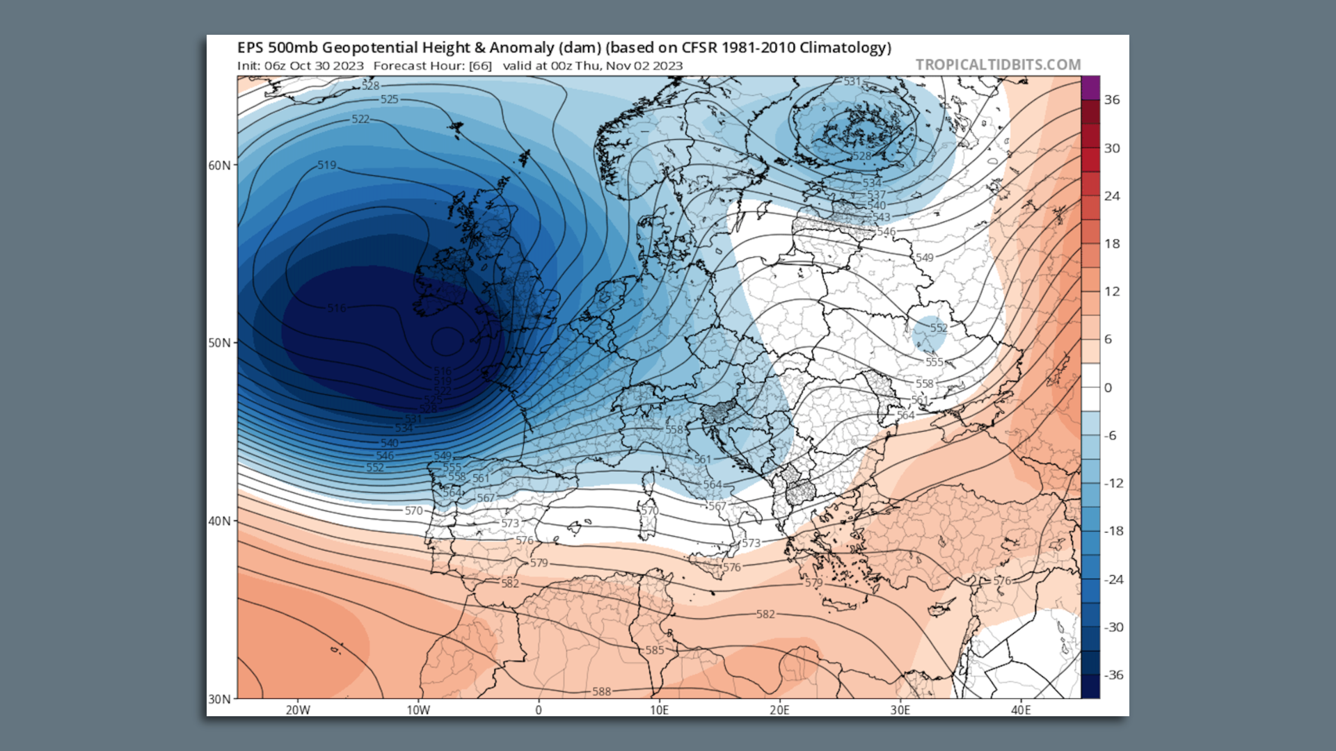
Map showing a computer model projection of the intense storm moving toward Western Europe midweek. Image: Tropicaltidbits.com
An unusually powerful storm is forecast to rapidly intensify and bring heavy rains and damaging winds to Ireland and the U.K., with its effects extending into France, Belgium, the Netherlands and other parts of Western Europe.
Driving the news: The timing of the storm is forecast for late Wednesday through the end of the week. The U.K. Met Office took the unusual step of naming the weather system days in advance, assigning it Storm Ciarán.
- Based on computer model projections, the storm could set records for the lowest air pressure readings recorded in the U.K. during the month of November, and potentially rival longer-term records.
- In general, the lower the air pressure, the stronger the storm.
- The tight pressure gradient around the storm will bring the threat of hurricane-force winds. Some exposed, coastal areas may see wind gusts of 90 mph, according to the Met Office.
- Damaging winds are likely to occur in London, with areas of northwestern France at particular risk of seeing the strongest gusts.
- Warnings have already been issued across the region, including an Amber Warning for heavy rains, due to flooding concerns in the U.K. and a red alert for parts of France due to strong winds expected later Wednesday.
Threat level: Ciarán comes after a separate storm struck the U.K. last week, leading to significant flooding in some areas.
- This makes more heavy rain an unwelcome development, since it could lead to renewed flooding in some of the same areas with already saturated ground, said Met Office deputy chief meteorologist, Steven Keates, in a statement.
- The Met Office has also issued warnings for southwestern and southern areas of the U.K. on Thursday due to the high wind threat.
- "Very strong northwesterly winds associated with Storm Ciarán could disrupt travel, utilities and may cause some structural damage," the warning states. "Flying debris could result in a danger to life."
Meanwhile, Météo France, the French government's weather agency, is predicting storm surge flooding in northwestern France from Wednesday night into Thursday morning, and "violent" winds as high as 90 mph.
- The national weather agency on Wednesday morning issued a red alert for regions including Brittany in northwestern France and Normandy in the country's north.
- Meteorologists are also warning of damaging waves along the northwestern coast and in the English Channel.
Context: Storm Ciarán will form from a mix of ingredients, including a powerful, 200-mph-jet stream at about 30,000 feet above the surface, an initial area of low pressure forming off the coast of Newfoundland, and record warm North Atlantic Ocean waters.
- These sea surface temperatures could lead to unusually heavy precipitation and a faster intensification rate than would otherwise occur.
- The warmer than average waters have been linked to human-caused climate change, with global average temperatures still running at their highest levels on record for this time of year.
Editor's note: This story was updated with the latest forecast information.
