Research: Protected land status determines a forest's fate
- Andrew Freedman, author of Axios Generate

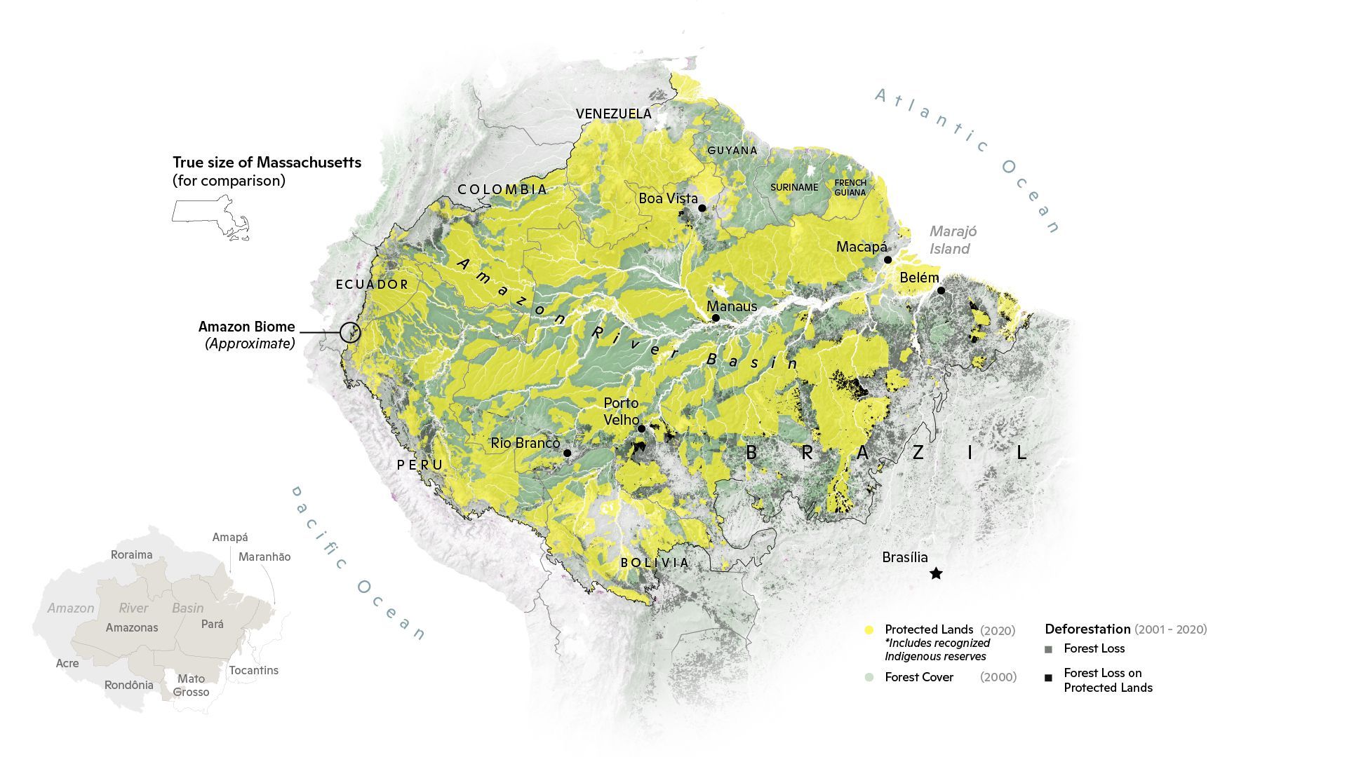
Data: Forest coverage and deforestation from Hansen, et al. 2020 version 1.8. Croplands from ESA Copernicus Land Cover 2019. Map: Carl Churchill, Woodwell Climate Research Center
With a global initiative on deforestation announced in Glasgow Monday, there's a spotlight shining on places like the Amazon.
- Researchers say that land status, such as whether a swath of rainforest is within a protected reserve or recognized indigenous lands, can be the determining factor in deforestation.
Why it matters: Due to land clearing for agriculture or other uses, parts of the Amazon have already passed a tipping point from a net absorber of carbon emissions to a net source, and the pace of deforestation has increased in recent years, threatening the Paris Agreement's temperature targets.
Context: The map above, by cartographer Carl Churchill of the Woodwell Climate Research Center in Massachusetts, shows the Amazon ecoregion of South America.
- Protected lands as of 2020 are seen in yellow. The area affected by deforestation in the last 20 years is visible in darker gray.
- For comparison, rainforest cover as of the year 2000 is also included (green).
- Major cities in the Brazilian Amazon are also depicted, as well as a figure showing the Brazilian states the basin covers.
The bottom line: Much of the deforestation in the Amazon during the past two decades has occurred outside protected lands.