Significant hurricane threat for Gulf Coast this weekend

Add Axios as your preferred source to
see more of our stories on Google.
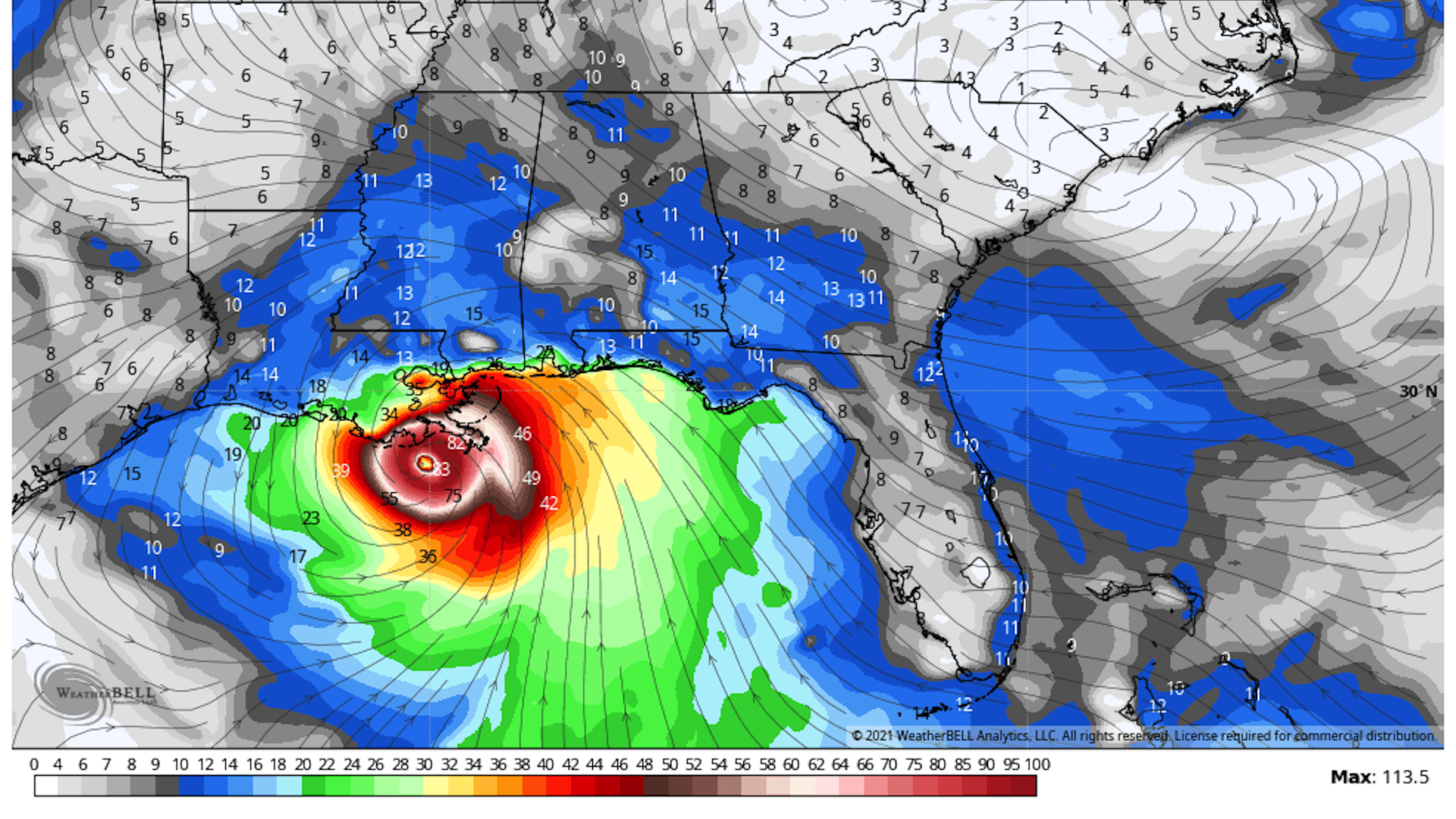
Tropical Storm Ida formed Thursday afternoon over the Caribbean Sea and has the potential to become a powerful hurricane over the Gulf of Mexico and strike the northern Gulf Coast by Monday, according to the National Hurricane Center.
The big picture: The Hurricane Center included unusually sobering wording for the first advisory on a storm, partly because the timing of landfall means there is only a few days for residents in the storm's potential path to prepare.
- Forecasters warned of the increasing "risk of life-threatening storm surge, damaging winds, and heavy rainfall" along the northern Gulf Coast.
Threat level:
- In a technical forecast discussion posted to its website, Hurricane Center forecasters flagged a scenario explicitly shown in a number of reliable computer models that forecasters use to predict a storm's track and intensity: that a favorable weather pattern and extremely warm sea surface temperatures will jump start the storm, allowing it to rapidly intensify.
- "There is higher-than-normal confidence that a strengthening tropical cyclone will be moving over the Gulf this weekend," NHC stated Thursday morning.
- Rapid intensification refers to a storm that exhibits an increase in its maximum sustained winds of at least 35 mph in 24 hours, and many of the strongest hurricanes and typhoons tend to through this process.
- Climate change studies show that rapid intensification may be becoming more common as the atmosphere and oceans warm in response to human-caused greenhouse gas emissions.
Between the lines: While forecast uncertainty remains high, given that the storm was so disorganized as of Thursday at midday, NHC meteorologists noted in their discussion that virtually every computer model shows the storm intensifying up until landfall, and being on the cusp of major hurricane intensity (Category 3 or greater) at that time.
The main factors favoring an intensifying storm include:
- Warmer than average sea surface temperatures.
- High pressure at upper levels of the atmosphere that will help enhance a storm's outflow pattern, allowing a hurricane to breathe as it draws air in at lower levels and sends it fanning out in all directions aloft.
- A lack of wind shear and dry air, two factors that typically cause storms to sputter, weaken or die altogether.
The bottom line: This storm presents the Gulf Coast with a perilous situation featuring an intensifying storm that is only a couple days from landfall, leaving coastal residents with limited time to prepare amid forecast uncertainty.
