Tropical Storm Henri set to strike Northeast with storm surge, inland flooding
Add Axios as your preferred source to
see more of our stories on Google.

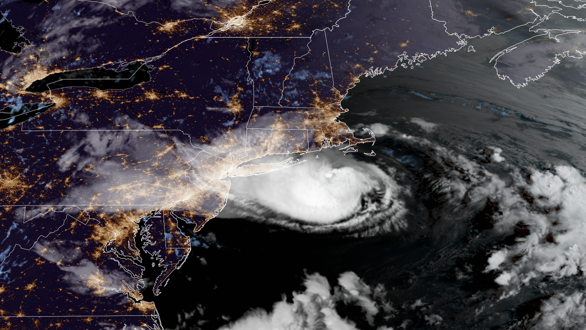
Tropical Storm Henri as seen from satellite imagery on Sunday. Photo: CIRA/RAMMB
Tropical Storm Henri was barreling toward the Northeast coastline Sunday morning, on track to make landfall in Long Island or southern New England later in the day.
The latest: The storm is packing maximum sustained winds near 70 mph with higher gusts, the National Hurricane Center (NHC) said in its 8 a.m. ET advisory. "Some slight weakening will be possible this morning, but Henri is still forecast to be a strong tropical storm when it reaches the coasts of southern New England and Long island," it added.
- Rapid weakening is expected after Henri makes landfall, per NHC.
The big picture: Henri was downgraded to a tropical storm early Sunday morning.
- The storm could affect the New York City metro area significantly. Widespread power outages were expected.
- Governors in Henri's path were preparing for the storm's arrival. New York Gov. Andrew Cuomo declared a state of emergency for Long Island, New York City, Hudson Valley, Westchester and the Capital District region.
Details: Henri will bring potentially deadly threats — including "life-threatening" storm surge flooding that could peak between 3 and 5 feet above normally dry ground, from Long Island (including Long Island Sound) and east to Nantucket.
- Its biggest dangers will likely be coastal storm surges and inland flooding from heavy rainfall.
- The surge itself will be accompanied by pounding surf that could cause considerable beach erosion all the way east to Cape Cod.
- Tropical storm warnings were in effect for Manasquan Inlet, New Jersey, to Chatham, Massachusetts, including Long Island and New York City, as well as Block Island, Nantucket and Martha's Vineyard.
- Storm surge warnings were in effect for East Rockaway Inlet to Mastic, New York, North of Chatham, Massachusetts, to Sagamore Beach, Massachusetts, and Cape Cod Bay.
Threat level: It won't take much rain to instigate flash and river flooding, since the northern Mid-Atlantic and New England have been particularly wet in recent weeks.
- Sunday was set to bring high astronomical tides due to the full moon, so the timing of landfall was crucial. If it were to strike land at high tide, the surge could be especially damaging.
- Given wet soils from recent rains, even tropical storm-force winds could cause widespread power outages, particularly in southeastern New York, Connecticut and Rhode Island.
- "Confidence is increasing in damaging to destructive winds, major (life-threatening) storm surge and flooding rains for LI and CT," stated the New York City office of the National Weather Service (NWS) in a Saturday briefing.
Editor's note: This article has been updated with further details on the storm's path.
