Google Earth rolls out "Timelapse" features showing climate change

Add Axios as your preferred source to
see more of our stories on Google.
/2021/04/15/1618502050533.gif?w=3840)
Satellite timelapse showing the retreat of the Columbia Glacier in Alaska between 1984 and 2020. Animation: Google Earth
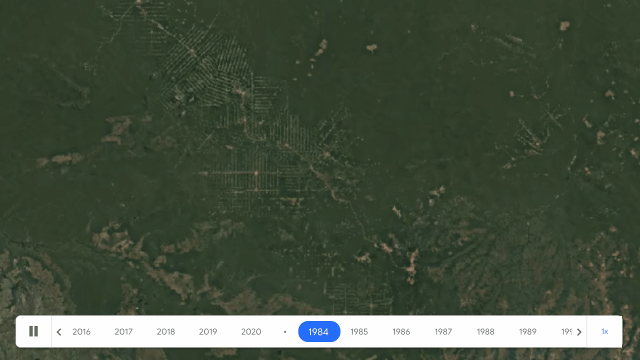
Google Earth on Thursday unveiled new features for its Timelapse tool that allows users to zoom in on locations to view more than three decades of imagery, including from their mobile device.
Why it matters: The result is a sobering look at the overwhelming human footprint on the planet, from melting glaciers in Alaska and Greenland to deforestation in South America and the rapid expansion of cities.
- By making intangible, long-term trends visible, the new feature provides scientists, journalists and activists with a tool that can tell stories but also ultimately may galvanize support for environmental protection.
How it works: Using Google Earth Engine the company combined more than 24 million satellite images, or "roughly 10 quadrillion pixels," to create the global cloud-free images that comprise Timelapse.
- The updated feature adds mobile and tablet support, which adds potential new avenues for storytelling about how human forces are reshaping the planet.
- The data sources include the U.S. Geological Survey/NASA Landsat satellites, as well as the EU's Copernicus Program and its Sentinel series of satellites.
- Another partner is Carnegie Mellon University's CREATE Lab, which helped to process and display the approximately 24 million satellite photos taken over 37 years.
Between the lines: The data processing requirements of turning all of these images into easy-to-access, compelling animations were enormous. According to a blog post on Google's website, the task required "More than two million processing hours across thousands of machines in Google Cloud to compile 20 petabytes of satellite imagery into a single 4.4 terapixel-sized video mosaic."
Yes, but: The computing was powered by data centers that use 100% renewable energy, the company stated, given the company's commitments to cut its own emissions.
What they're saying: "Our planet has seen rapid environmental change in the past half-century — more than any other point in human history," wrote Rebecca Moore, director director of Google Earth, Earth Engine and outreach.
What to watch: The data isn't just useful for doomscrolling, but in fact the imagery is also being integrated into peer-reviewed research. There may be innovative studies yet to come on climate change and other topics, inspired by or using Google Earth data sets.
- One study, published in the journal Nature in 2019, used the older version of Timelapse to show a 6,000% increase in summertime landslides on a Canadian Arctic island since 1984.
- The study attributed the landslides to the melt of permafrost, a layer of permanently frozen soil found in the high Arctic.
