Simulations could have real-world impact on decongesting city streets

Add Axios as your preferred source to
see more of our stories on Google.
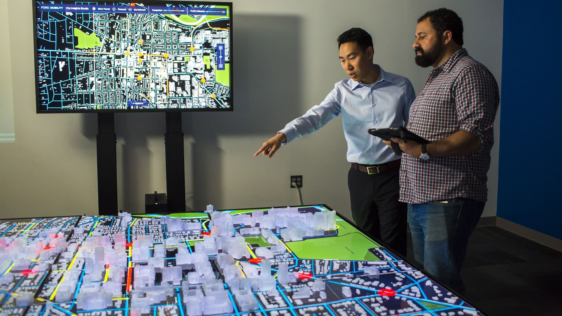
Ford technicians study City Insights Studio. Photo courtesy of Ford
As cities get more crowded, companies are developing SimCity-like software that help urban planners plot better transportation networks.
Why it matters: These software programs enable communities to visualize the movement of people and goods around their city and develop solutions to reduce congestion and improve safety.
- This is important because it's getting tougher to move around some cities, which are coping with population growth, worsening traffic and deteriorating public transit. And, the arrival of self-driving cars could improve conditions — or make them much worse.
- Companies like RideOS and Bestmile are developing fleet optimization software to make transportation networks more efficient.
- Another startup called Remix brings together disparate data sources into one view of a city’s transportation picture for better decision-making.
Zoom in: Ford’s City Insights platform also brings together data not usually found in one place so cities can view their entire transportation system holistically and explore solutions to traffic and safety problems before implementing them in the real world.
- It has a secondary purpose, though: Ford wants to understand how its robotaxis and automated delivery vehicles might fit into the mix one day.
What's new: Ford is piloting the City Insights software in Ann Arbor, Michigan, where it works with city planners and other organizations to analyze specific transportation issues in the growing college town of 121,000.
How it works: Communities like Ann Arbor collect lots of transportation-related data, but don't often share it across departments or organizations. This limits visibility into what's really happening on the roads.
- Ford pools parking, transit, traffic, safety and census data about Ann Arbor and uses its suite of software tools to bring it to life with a digital model of the city across 6 LCD screens, including miniature 3D-printed buildings.
- The interactive tabletop offers planners a way to visualize information they might miss on a spreadsheet.
- They can then analyze traffic patterns and simulate various scenarios.
What they learned:
- Planners thought Ann Arbor needed more parking, but changed their minds after visualizing traffic flows and are now working on directing drivers to open spaces — a much cheaper alternative.
- To improve safety, they identified the riskiest intersections by analyzing crash data from police reports alongside Ford's own connected vehicle data, showing instances of sudden braking, for example, which could suggest near-misses.
- They also studied movement in back alleys, to see how city services could be improved. "If a garbage truck can’t enter an alley as part of its normal route, that doesn’t just create traffic. It costs the city money and negatively impacts the quality of life for residents and businesses," Brett Wheatley, Ford's VP of mobility marketing and growth, writes in a blog post.
What's next: Ford will expand the use of these tools to 6 more U.S. cities, including Austin, Indianapolis, Pittsburgh and Detroit.
