Here are the answers to your questions about hurricanes

Add Axios as your preferred source to
see more of our stories on Google.
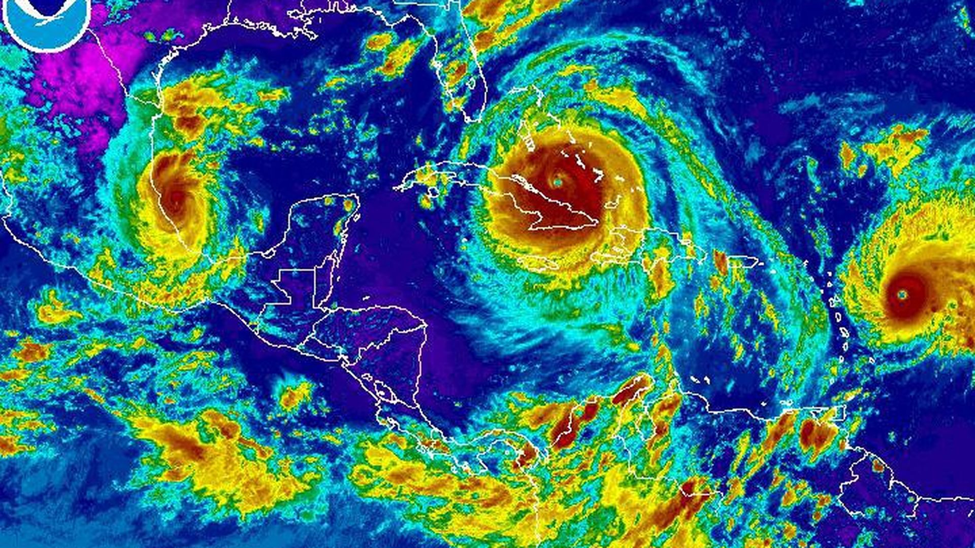
NOAA / GOES
With three major storms in the Atlantic following on the heels of Harvey, all eyes are on hurricanes.
From storm strength to forecasts, here are answers to some of the biggest questions surfacing on social media.
What's an 'eyewall' and why do we care about its replacement cycle?
- An eyewall is a line of rapidly moving thunderstorms circling the eye of a hurricane. It generally has the highest, most damaging winds.
- Over the life of a storm, the eyewall will go through a "replacement cycle."
- As it breaks up, hurricanes generally decrease in strength. Sometimes, when the eyewall reforms, the hurricane returns stronger than before. That's why some hurricanes cycle between different categories.
- This morning, Irma's eyewall went through a replacement cycle. When it reformed, the storm was downgraded from category 5 to 4, but the eye was much larger than it had been previously. That means that a larger area will experience the destructive eyewall — and means that the hurricane might restrengthen to a category 5.
What do the cones on hurricane forecast models mean?
The cones represent the most likely path of the eye of the hurricane. Damaging effects can and will be felt outside of the cone. As the hurricane's path becomes more uncertain, the cone becomes larger. The National Weather Service's forecast cones include two sections: a three-day forecast, symbolized by solid colors, and a less-certain five-day forecast shown in dots.
What's the deal with the Saffir-Simpson scale?
- If you've ever looked at the Saffir-Simpson scale that ranks hurricanes on a scale of 1-5, you might have noticed something strange: that the wind speed gaps aren't even.
- A Category 3 hurricane has sustained winds between 111 and 129 miles per hour, while a Category 4's goes from 130-156 miles per hour
- That's because the scale isn't scientific, it's tool that uses windspeed to estimate potential property damage.
- The categories are tied to how extreme the damage will be and how long it will take to recover. A Category 3 storm, for example, will cause "devastating damage," snapping some trees and causing electricity outages that last days.
- A Category 4 will cause "catastrophic damage" including uprooting or snapping most trees and causing electricity outages that last months, and the area will be "uninhabitable."
- That's why there's no Category 6: there's no point from a disaster-preparedness point of view. If a Category 5 is almost total devastation, there's not much beyond that.
How does a hurricane get so strong?
Hurricanes require two things to form:
- A lot of warm water - over 80 degrees Fahrenheit.
- And very little wind shear. Wind shear can essentially cut off the top of the hurricane, stopping it from forming.
Irma has been passing over some of the warmest water recorded in the Atlantic. This adds energy and moisture to the system, increasing its strength. If the hurricane passes over land, it will lose strength rapidly. That's why Irma's predicted to drop down to a still-damaging Category 1 storm before exiting Florida through the North.
Is it unusual to see this many hurricanes in the Atlantic at once?
Not necessarily, but it is unusual to see this many strong hurricanes at once. This is the first time since records began that two hurricanes with winds over 150 miles per hour have existed in the Atlantic ocean at the same time.
What's the difference between a cyclone, hurricane, and typhoon?
They're all the same — it's really just semantics. Hurricanes form in the Atlantic and on the North American side of the International Date Line in the Pacific. If it's on the Western Pacific, it's a typhoon. And if it forms in the Southern Pacific, it's a cyclone.
