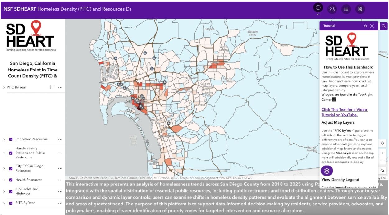
Using AI to map homelessness

Add Axios as your preferred source to
see more of our stories on Google.

Illustration: Lindsey Bailey/Axios
AI is helping San Diego State University researchers build a comprehensive, real-time map of the homeless population and resources across the city.
The big picture: The map shows hot spots of homelessness in specific neighborhoods, plus movement and migration patterns throughout the year, professor Ming Tsou told Axios.
- The interactive map seeks to create a more thorough view of homeless encampments throughout the year, which researchers say could make services more targeted and efficient.
Between the lines: Such camps are migratory because street sweeps and San Diego's encampment ban keep people on the move, Father Joe's Villages' chief strategy officer Joshua Bohannan told Axios.
- With a more detailed understanding of where, how and when homeless people are moving, they can better predict where to send outreach workers and street health teams, he said.
SDSU's map offers an unprecedented view of the landscape, Bohannan noted.
- "At this scale, consolidated in one space, where hopefully it continues to be updated, that just doesn't really exist," he said.
The intrigue: The map could also help homeless people find "safety in community" or get help from services that are concentrated near specific transit lines, Bohannan noted.
- Yes, but: The map is publicly available, and Bohannan said it risks putting a target on homeless people.
Reality check: The "incredible lack of resources" for countering San Diego homelessness is already well-known, and it remains unclear if another map will truly help the problem, homeless advocate Michael McConnell told Axios.
- Less than 10% of people trying to get a spot at city-funded shelters are able to get in, McConnell noted.
- "When the decision-makers are already not even supplying anywhere close to the need, another map isn't going to help them," he said. "It's more the will to actually do something with the information."
Zoom in: The map relies on AI to identify the location of homeless encampments in San Diego using aerial photos and street view images or videos, Tsou said.
- It integrates local data sources, including annual point-in-time counts, monthly downtown surveys and Get It Done reports.
- Researchers have also pinpointed shelters, food banks, health clinics, hand washing stations, bathrooms and other outreach services.
What's next: The ongoing project, which includes a working prototype, is funded by a National Science Foundation grant through the next three years.
- The team plans to create a consortium of local organizations and government agencies to collaborate on continuing the project.