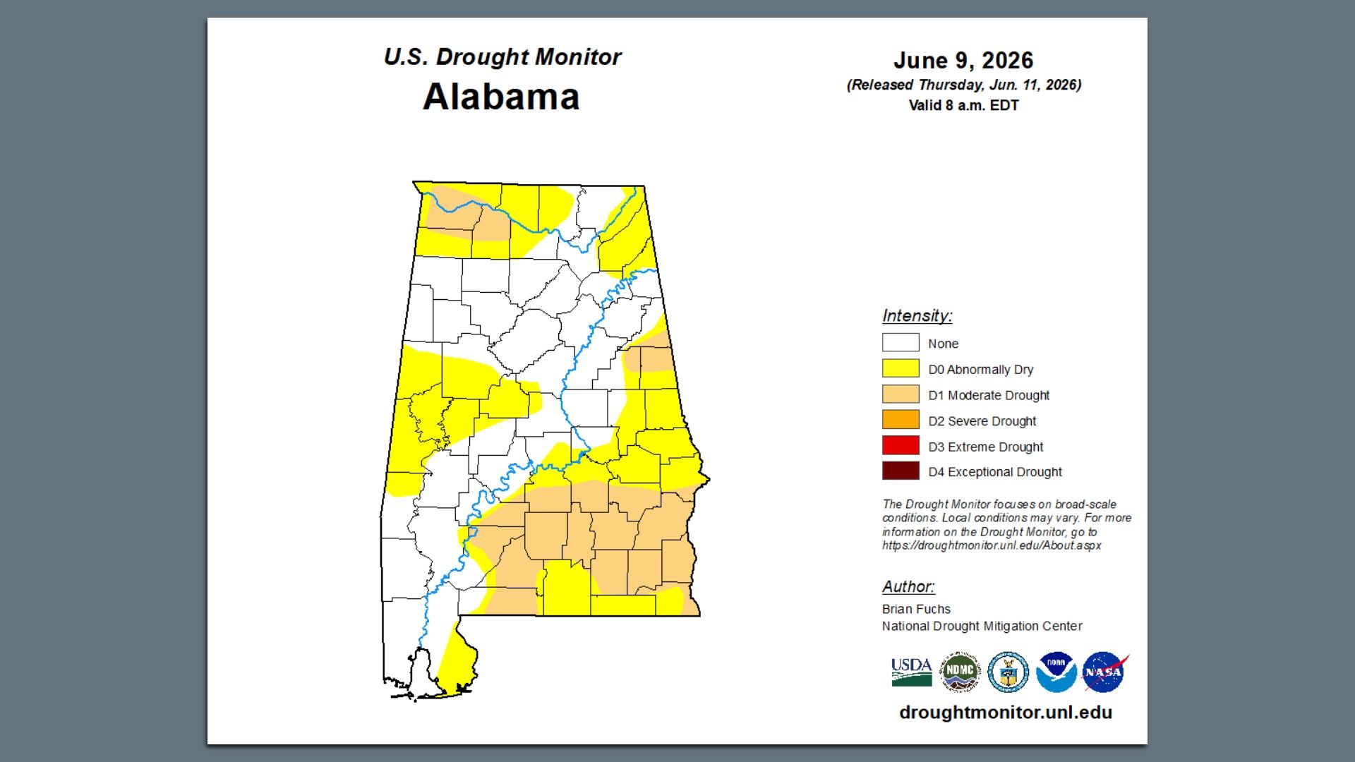
Map: U.S. Drought Monitor. The U.S. Drought Monitor is jointly produced by the National Drought Mitigation Center at the University of Nebraska-Lincoln, the United States Department of Agriculture, the National Oceanic and Atmospheric Administration and the National Aeronautics and Space Administration. Map courtesy of NDMC.
The drought that's persisted in North Alabama since last December is finally on the way out, and more rain is on the way.
State of play:Almost half the state, including a portion of Madison County, is no longer in a drought thanks to recent heavy rains, and the forecast looks likely to further improve those conditions.
About 34% of the state remains in the D0-Abnormally Dry category, and about 20% is in D1-Moderate Drought conditions, mainly in the southeast and the Shoals.
What they're saying: "There's been some significant improvement in the last couple of weeks," Andrew Pritchett, lead forecaster with the National Weather Service in Huntsville, told Axios. "We've improved a category a week."
Context: The Huntsville area saw almost 8.5 inches of rain in May, approaching twice the normal amount of 4.67 inches, per NWS.
Heavy rains last weekend dropped 7-plus inches of rain in Madison County in 24 hours, and more than 9 inches near Hazel Green from last Saturday night to Monday morning, per AL.com.
What we're watching: More rain is on the way.
Over the next few days, 3-5 inches of rain are forecast for the area, Pritchett said, with concerns of more localized flash flooding thanks to still-sodden soils.
That means this time next week, when the next Drought Monitor map publishes on June 18, there will likely be more improvement.
Zoom in: Very humid conditions will welcome a weak cold front starting today, he said, which "won't change the air mass a lot, but will provide a focus for thunderstorms."
Conditions will favor damaging winds and frequent lightning, and any sudden storms could trigger more flooding on already-wet ground, he said.
Then on Sunday, a broad area of low pressure will move over the Valley and stall potentially into Tuesday, Pritchett said, with less severe weather but plenty of rain.