Tropical rainstorm floods Carolinas with heavy rains, threatens Mid-Atlantic

Add Axios as your preferred source to
see more of our stories on Google.
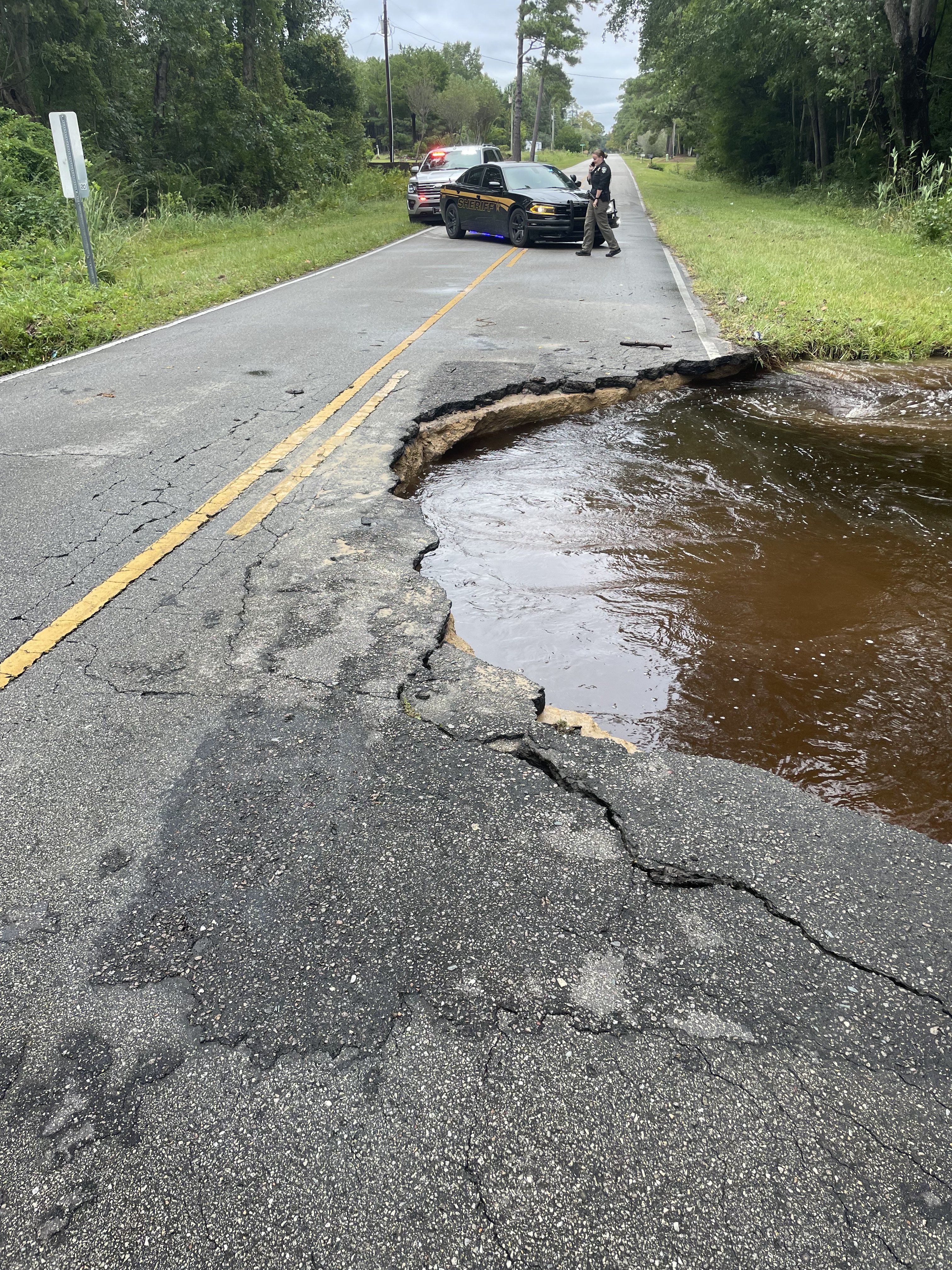
A flooded road in Brunswick County, North Carolina, during a massive rainstorm on Sept. 16. Photo: Brunswick Sheriff's Office/X
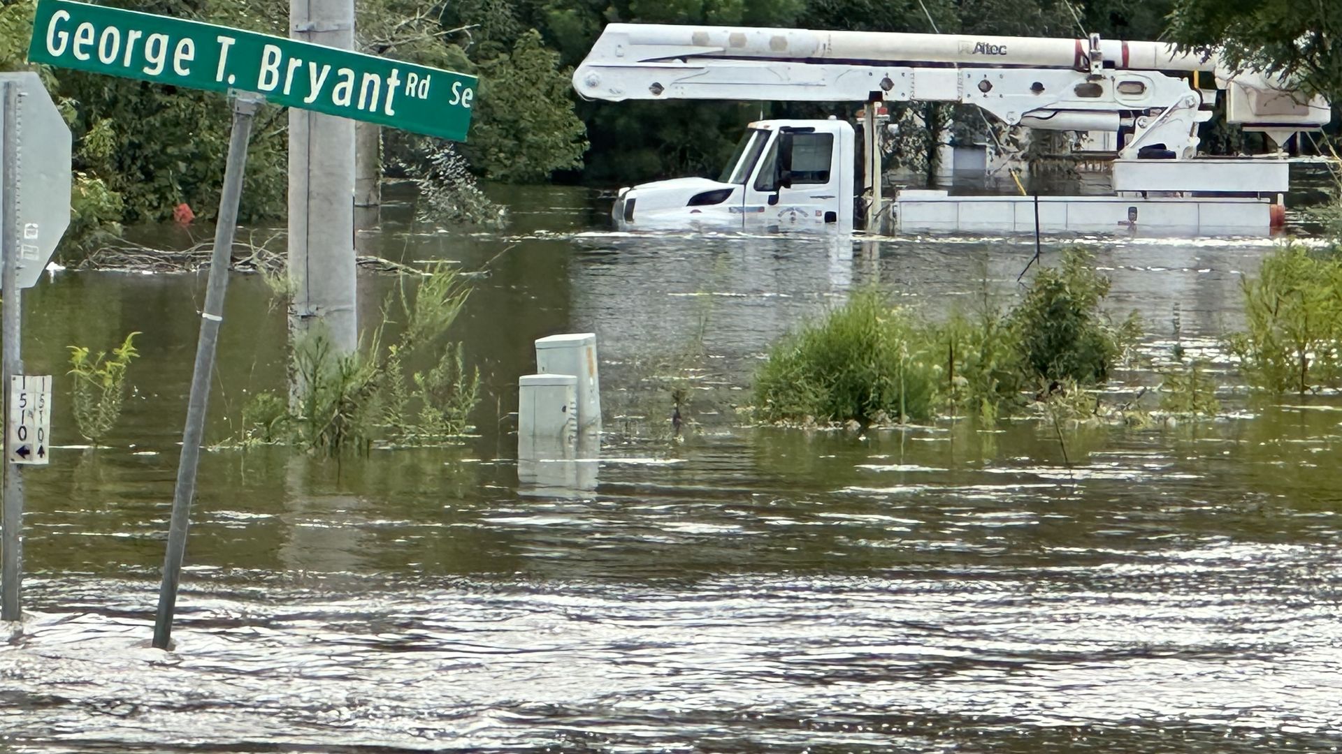
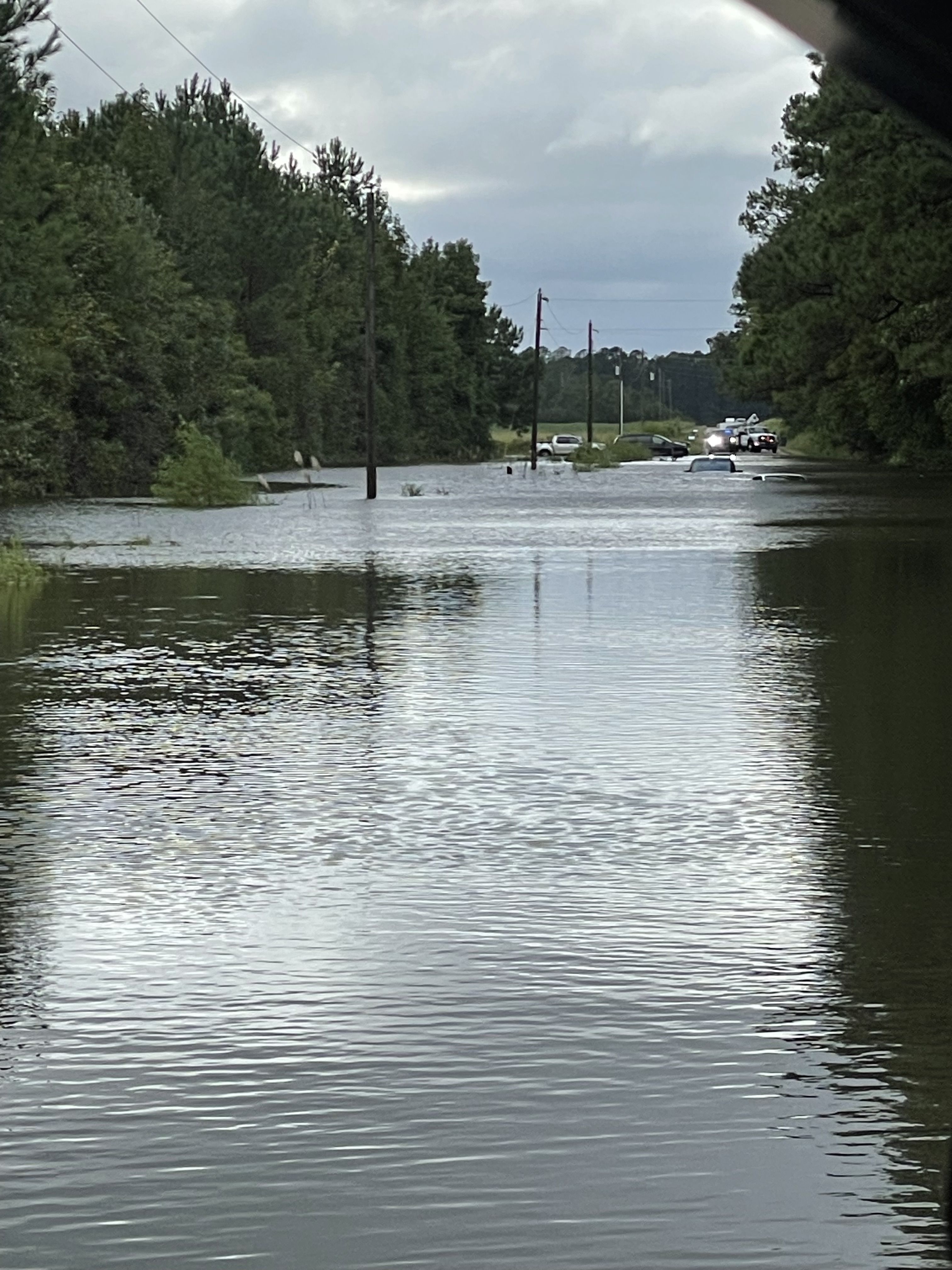
A tropical rainstorm that is taking aim at the Mid-Atlantic has flooded the Carolinas with "historic" rains, inundating homes, roads and vehicles and prompting water rescues.
The big picture: Flash flood and tropical storm warnings were in effect for portions of North and South Carolina Monday into Tuesday due to the unnamed system that the National Hurricane Center referred to as Potential Tropical Cyclone 8, as it dumped more than a foot of rain in some places.
Threat level: The storm was "making landfall near the North/South Carolina border" on Monday and bringing "gusty winds, heavy rain, and embedded strong thunderstorms up the Carolinas into portions of the Mid-Atlantic," the National Weather Service said in an advisory.
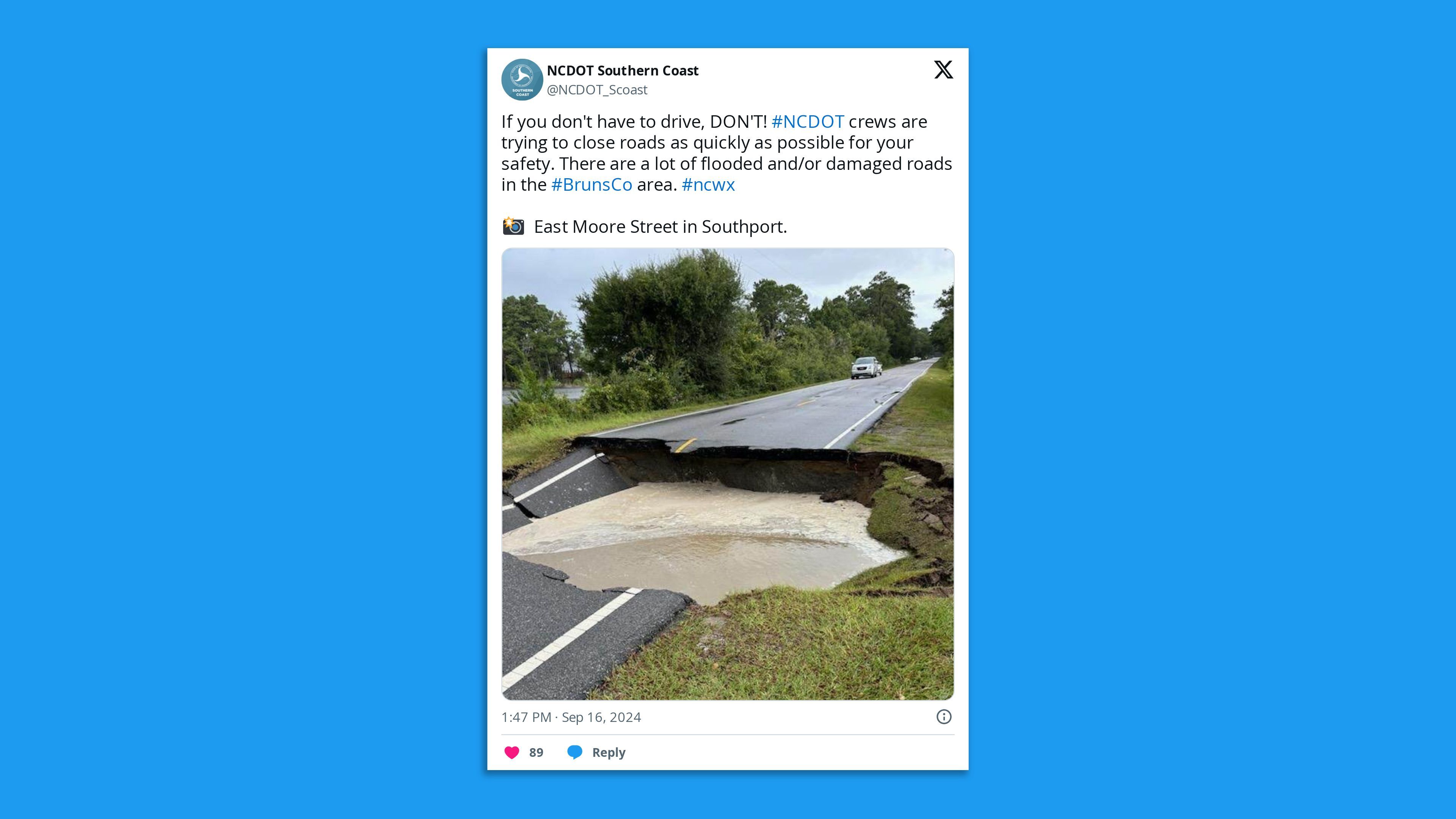
- "Historic rain has fallen across Carolina Beach, Southport, and Boiling Springs Lakes today," the NWS' office in Wilmington, N.C., said in a Facebook post Monday.
- "Multiple volunteer gauges have recorded over a foot of rain since midnight and considerable flash flooding continues to affect roads, homes, and businesses in these areas."
- The office said in another update on X that "life-threatening flash flooding is ongoing."
By the numbers: Carolina Beach in New Hanover County, N.C, saw 18.32 inches of rainfall by Monday afternoon, while Hood Creek in Brunswick County recorded its highest water level ever at 14.11 feet during the deluge.
- This was due to the combination of heavy rain and storm surge flooding pushing water inland from high winds.
State of play: Multiple rescues were reported in New Hanover and Brunswick counties during Monday's deluge.
- Heavy rains and embedded strong thunderstorms were slamming the coastal plain of North Carolina in particular, according to the NWS.
- "A few tornadoes cannot be ruled on either across eastern North Carolina through this evening," the weather agency said.
- "Flash flooding will be a concern, especially in the eastern Carolinas where the highest rainfall totals are forecast for tonight," it added.
- The deluge prompted Brunswick County offices and facilities including libraries, parks and landfill to close on Tuesday.
What's next: The storm was forecast to move slowly inland near the border of North and South Carolina and "steadily weaken as a swath of heavy rain overspreads mainly across North Carolina into portion of South Carolina through much of Tuesday," per the NWS.
- The storm's remnants will then spread northward into the Mid-Atlantic later Tuesday and into Wednesday, "bringing a threat of flooding rains but the intensity of the rain is forecast to gradually decrease with time."
- There's a slight risk of excessive rainfall (level 2 of 4) Tuesday across central and southeastern Virginia as the remnants of the storm move northward.
- "Flash and urban flooding also is possible," per the NWS.
Context: Climate change is leading to more frequent and intense extreme precipitation events, multiple studies show.
Andrew Freedman contributed reporting.
In photos: Heavy rains inundate streets across the Carolinas
Editor's note: This article has been updated with more photos, details on the storm and further context.
